
Olathe Neighbor Records by Source
The immediate block around an Olathe address can be examined through several public systems. Each has a narrow role. AIMS defines parcels and mapped geographies. The tax roll identifies an owner and billing contact. Election records reflect registration, while city neighborhood records describe voluntary civic groups. None proves that every person shown is physically present today.
| Olathe block source | Evidence about nearby places | Public access route |
|---|---|---|
| Johnson County Online Mapping | Parcel outlines, nearby addresses, subdivision, ZIP, ward, school, census, and neighborhood layers | Public map and identify tools |
| County property and tax search | Owner name, site address, billing address, parcel and tax context | Free address, name, or Quick Reference search |
| Recorded plat and declarations | Lot and block identity, subdivision limits, recorded association rules | AIMS Plat Search and Register of Deeds terminal |
| County voter information | Defined registration and district fields in a requested file | Fee-based county request with statutory limits |
| Registered-neighborhood list | Group name, boundaries, and primary contact | City PDF, not a household roster |
| Sanborn and historic road records | Earlier buildings, street form, road packets, and block context | KSHS, libraries, and AIMS right-of-way search |
The owner's mailing address may differ from the parcel's site address. That can suggest an owner lives elsewhere, but it does not establish who occupies the property. Use role labels such as owner, registered voter, civic contact, or recorded deed party instead of calling every name a neighbor.
Map Nearby Olathe Neighbors
Johnson County Online Mapping can search an address, identify adjoining parcels, and display only the layers needed for a block question. Save the subject parcel ID and the map date first. Then decide whether “nearby” means touching lots, parcels within a fixed radius, the same platted block, or a named neighborhood. Those are different geographic tests.
- Search the exact Olathe site address and confirm the parcel outline, Property ID, legal description, and subdivision.
- Turn on address points and parcels. Click each touching parcel and record its own site address and parcel ID.
- Use the Buffer tool for a repeatable radius. Enter feet, select parcels or visible layers, and note the map extent.
- Compare results with plat, neighborhood, ZIP, ward, school, voting, and census layers. Label each boundary type.
- Open the tax record only when an owner field is relevant, and keep owner separate from occupant.
That process is for one block or radius. A full named-road chain belongs in the Olathe street directory, where each address is followed along the street rather than outward from one parcel.
Define an Olathe Neighbor Block
A subdivision block comes from a recorded plat. A census block is a Census Bureau unit. A neighborhood may be a city-registered civic boundary or an AIMS map layer. Residents also use “block” informally for the homes between two cross streets. Write down which meaning applies before collecting names or counts.
- Parcel
- A mapped unit of land with its own county identifier and legal description.
- Plat block
- A numbered group of lots shown on a recorded subdivision plat.
- Buffer
- A measured zone drawn around a map feature to select nearby parcels or layers.
- Census block
- A statistical geography that may not follow a subdivision or local neighborhood.
Drainage land, a street centerline, a subdivision edge, or annexation history can split what appears to be one block. Use the source's exact geography rather than smoothing those differences away.
Note: A 200-, 500-, or 1,000-foot Register of Deeds buffer request is a records radius, not proof that each result is a neighbor.
Olathe Plats Connect Neighbors
The recorded plat is the cleanest way to determine whether nearby parcels share a subdivision, block, or lot scheme. It can also explain a small outlot, common tract, or street that makes map adjacency misleading. The Johnson County plat search is the public starting point.
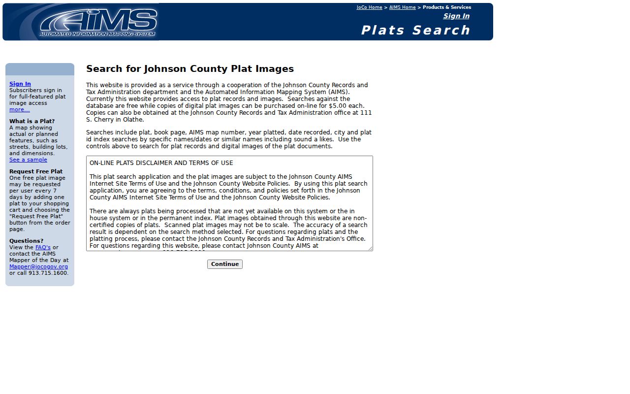
Read the plat name, book and page, block, lot, recorded date, and any later replat. For association restrictions or declarations, the Register of Deeds FAQ directs users to the public terminal. The office does not maintain a directory of HOA board members or household rosters.
Olathe Neighborhood Contacts, Not Rosters
The city's registered-neighborhood list, updated October 15, 2024, publishes a group name, stated boundaries, and a primary contact. Examples include Central, Downtown, Old Havencroft, Eastbrooke, Forest Hills, Northridge Park, Prairie Farms, Quail Park, Stonebrook, Woodland Creek, and Woods of Mahaffie. These entries identify civic points of contact. They do not list all Olathe neighbors.
Registered groups
Use the city PDF for the current boundary wording and primary contact. Compare that description with the subject parcel.
Healthy Neighborhoods
City neighborhood services provide notices, surveys, reports, and grant information for registered groups.
Olathe Planning
Planning answers boundary and neighborhood-program questions at 913-971-8750 or PlanningContact@OlatheKS.gov.
Registered groups may qualify for community-engagement grants up to $2,000 and beautification grants up to $4,000, with listed quarterly deadlines. That program role explains why a primary contact is public. It does not turn the city list into a resident directory.
Olathe Neighbor Voter Limits
Kansas VoterView is designed for an individual to check registration and polling information using personal details. It is not a public map of every voter on an Olathe block. Johnson County separately accepts voter-information requests for defined file fields, fees, and permitted uses.
K.S.A. 25-2320a restricts commercial use of voter registration lists. Kansas public-record law also bars using certain lists of names and addresses for commercial solicitation. Preserve the Election Office's use warning with any file and do not imply that registration proves a person currently lives at an address.
People enrolled in Kansas Safe at Home may use a substitute address. Some other owner or voter information can also be protected under law or policy. An absent name therefore does not prove that no one lives on the parcel.
Olathe Neighbors Cross Map Lines
AIMS can display ZIP, ward, voting precinct, school, city, neighborhood, subdivision, and census layers over the same parcels. These boundaries serve different offices and can divide nearby homes in different ways. A mailing ZIP does not define city limits, and a registered neighborhood does not necessarily match the mapped neighborhood layer.
Olathe says annexation does not itself change an address, school boundary, or zoning. The city reported that four 2024 annexations added 358 acres and brought its area to 65.4 square miles. Use the annexation map and ordinance date when a block sits near the municipal edge, but retain the postal and parcel labels found in the original record.
Read Olathe Neighbor Map Fields
An AIMS location report can carry a Property ID, site address, legal description, block and lot, subdivision, plat, owner and billing address, year built, zoning, land use, tax unit, ZIP, voting precinct, school districts, census geography, and nearby-address links. Treat those as fields from one compiled county report. The map combines deeds, plats, tax records, and other sources, and it is not a boundary survey.
Save the report date and the identifiers used. If an owner field is protected or unavailable, do not try to defeat that limit through a second source. Instead, keep the parcel and public geography facts that answer the block question. AIMS states that current property information is uploaded nightly, while changes commonly appear within about two weeks of an RTA request.
Historic Roads Reframe Olathe Neighbors
Black Bob and Lackman, Lone Elm and Parker or K-7, Sheridan and 143rd, Mur-Len, Santa Fe, and Strang Line can appear under different forms in older Olathe material. The city's chronology also notes use of the Kansas City, Missouri numbering system on the east side, though no exact renumbering date was verified.
The AIMS Historic Right-of-Way Search covers road data from 1850 through 1949 and exposes road names, packet numbers, road book and page, and section-township-range fields.
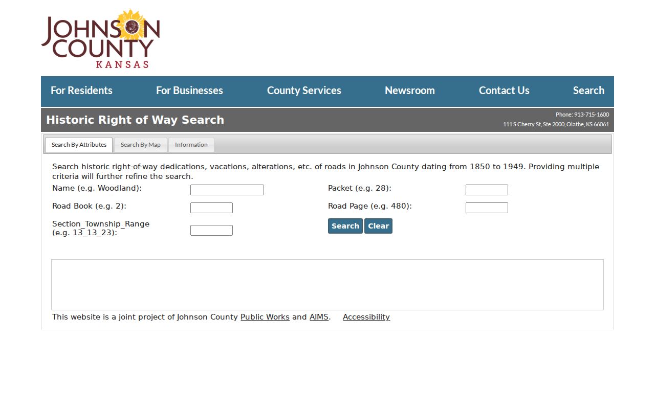
A road packet can explain why the historic block does not align with today's street. Pair it with a recorded plat and a dated Sanborn sheet before treating old buildings as the same set of neighboring parcels.
Official Olathe Records Compare Better
Commercial neighbor tools often blend old addresses, phone data, and unverified associations. Official records are narrower, but each name comes with a custodian, record role, and date. That makes them easier to check and correct.
| Method | Best use | Main limit |
|---|---|---|
| County parcel and tax records | Identify land and recorded owner | Owner is not necessarily an occupant |
| Election or civic records | Confirm a defined registration or group role | Restricted use and dated status |
| Commercial category | Possible lead only | Mixed sources, unclear dates, and weak correction paths |
For civic curiosity or personal safety, verify a key fact with the official custodian. Do not publish a broad list of nearby names merely because a commercial result associates them with the same street.
Protect Privacy of Olathe Neighbors
Public parcel data generally does not name renters, children, guests, or every member of a household. Utility, delivery, and private membership records are not open block directories. A primary civic contact represents an organization, and a billing address is an administrative field. Neither should be recast as a complete household record.
Date every result and keep the narrow role that the source assigns. If the goal is to introduce yourself, use a direct, respectful approach or a public neighborhood contact. Never infer sensitive personal facts from a parcel, voting district, or map layer.
Lawful use. Use Olathe neighbor records for civic context, reconnection, or personal safety awareness. Do not watch, intimidate, harass, or harm anyone.